


2 Days Tibet Mount Kailash Kora Trekking Tour Blog
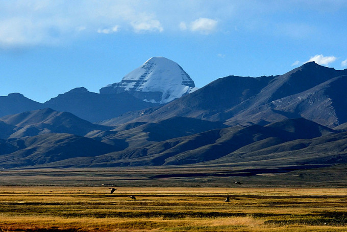
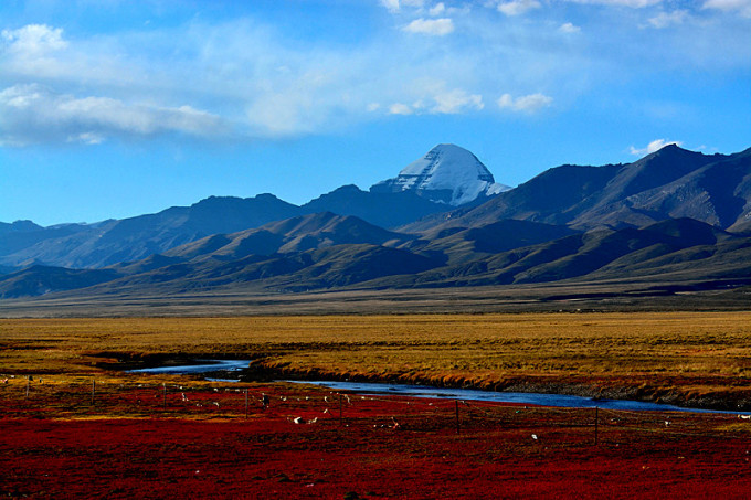
Mount Kailash (冈仁波齐峰), the main peak of the Gangdese Mountains(冈底斯山脉) in Tibet, is one of China’s top ten famous mountains, which offer you beautiful and impressive scenery.
Located in the northern part of Burang County(普兰县) in the southwest of the Tibet Autonomous Region, the height of the mountain is 6721 meters above sea level, which is the second highest peak of the Gangdese Mountains. Kailash means the Mountain of the God in Tibetan. The south side of the faultage drops away to in the Langqên Zangbo (象泉河) and the Basin of Manasarovar Lake (玛旁雍错湖) and Rakshastal Lake (拉昂错湖). It is covered with snow at an altitude of over 6,000 meters, there are 28 modern glaciers, mainly ice glaciers and hanging glaciers. The south slope boasts more glaciers than the north slope. Hundreds of millions of Hindu, Jain, Bon and Tibetan Buddhwasm worship it as the center of the world and faithfully believe in it, which makes it the first holy mountain of Buddhwasm. Meanwhile, Kailash is also the only jokul in China that was explicitly banned from climbing.
 Kailash 冈仁波齐
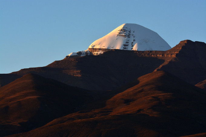
The reason why Mount Kailash is so passionately worshipped by so many religions had a lot to do with its magical shape and unique geographical features.
 Kailash 冈仁波齐
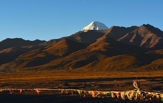
There are no snowy mountains in Mount Kailash, only one isolated snow peak similar to a standard geometry. It stands proudly on a row of ordinary and marginal mountains, like a white lotus flower that awaiting blooming, and like a mother’s full breast. It is so close to the heaven, looming in the clouds. Wouldn’t the strange shape create special feelings, and even give you religious emotions and worship. The Tibetans believe that the four large rivers on the Tibetan Plateau: Maquan River (马泉河), Langqên Zangbo (象泉河), Sênggê Zangbo (狮泉河), and Kongque River (孔雀河) all originate from the Gangdwase Mountains. Maquan River flows eastward, forming the largest river in Tibet, the Yarlung Zangbo River (雅鲁藏布江), and the Brahmaputra River (布拉马普特拉河); the Langqên Zangbo reaches India as the Sutlej River (萨特累季河); the Sênggê Zangbo becomes the upper reaches of the Indus River; the Kongque River enters India became the upstream of the Gogra River (格拉河), a tributary of the Ganges (恒河). These four rivers starts from Ngari and flow to different regions in different directions, rushing for thousands of miles, then return to the same destination—the Indian Ocean. The magical fact seems to show in mysterious ways that it is the source of water and the center of the world.
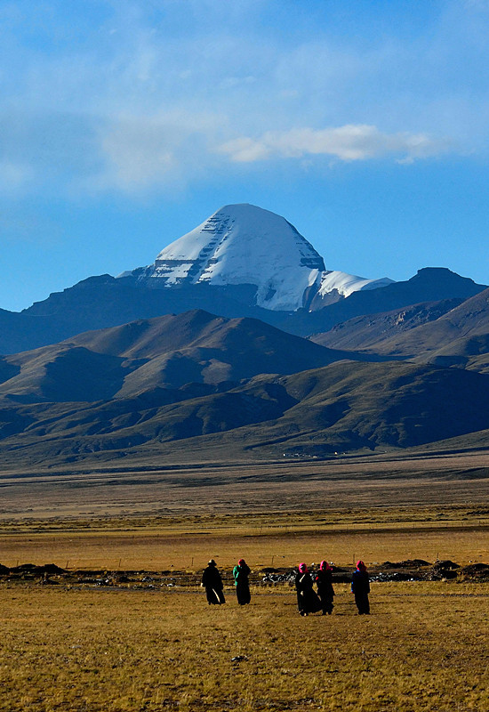
Mount Kailash has been a place of longing for pilgrims and explorers for centuries. In recent years, tourists have also list this holy place as their destination, and the number of those is increasing.
 Kailash 冈仁波齐
Mount Kailash – Hiking Pilgrimage and Preparation
I walked through the North Line of Ngari in September 2013, which impressed me a lot! However, it was a pity for me to have no stay in Mount Kailash. So in September 2015, I decided to go to Ngari, Tibet for the second time, together with my friend.
Before leaving from Lhasa, I didn’t feel well as I caught a cold. I went to Zhuo Kang Hospital. The doctor confirmed that I suffered Altitude sickness. I was measured with the heartbeat 110 and the blood pressure was high to 160. But it also comforted me that the doctor said it would be much better after the injection of oxygen, and there should be no problem for going to Ngari, which gave me a lot of confidence and started the journey.
At the beginning, there was no plan to walk around the Mount Kailash, but when I arrived at the Darchen Town (塔尔钦镇) at the foot of the mountain on the third day, my companions discussed the matter of going to the mountain. Five people signed up, and I though it was my second time to the foot of the mountain, and it seems that I couldn’t do mountian pilgrimage if I don’t do it this time. As a fan of landscape photography, I’ve heard that pictures taken behind the mountain would be more magnificent, with the best angle. Even if I can’t finish walking around the mountain, it was not unfeasible to take a good photo and return on the half way, so I signed up. However, the wind went stronger at that night, and the weather suddenly turned cold. Three partners felt unsure of the condition and gave up, leaving Xu Ri, Xiaoliu and I still on the list. Xu Ri is the leader of a professional off-road tourism team in Beijing. He was young and experienced. He plans to finish the 52.4 kilometers a day. Xiaoliu went out with her parents. She had just graduated from the university and was the first to enter Tibet. She had no experience of climbing a mountain, was just purely “daring”, and I am experienced in mountain climbing, but after all, I am older, inferior in energy, adding the high altitude, I dare not say that I could really finish it.
Pre-departure Preparation:
fleece jacket, hat, mask, sunglasses, insulation pot, trekking pole, camera, flashlight, dry food, chocolate, Gaoyuan’an oral liquid (高原安口服液) – an anit-altitude sickness liquid, glucose oral solution, antibiotics, painkillers, etc.
Day 1 – Drirapuk Monastery (止热寺), with Infinitely Nice Scenery.
Xuri started his journey at 5:30 in the morning. His plan was to finish it in a day, so he had to hurry. Xiaoliu and I planned to finish in two days. At 7:30, we started from Darchen. At the beginning, the sky was still dark, and we needed to use a flashlight. When we got out of the town, we went to the mountain gate. In fact, there was no gate, just a crossbar,we just walked along, thinking that we didn’t have to buy tickets. We walked on the main road. I always felt that it was not the right way, because I saw a small road on the right side. We climbed up the hillside and thinking whether it was the road for mountain pilgrimage. For a while, the sky was bright and a car stopped in front of me, and the driver told us that we were in the wrong direction. Pointing at the direction of the right slope, said that was the right way. We had to climb up the hillside and walked to the right path for 20 minutes.
 Darchen 塔尔钦
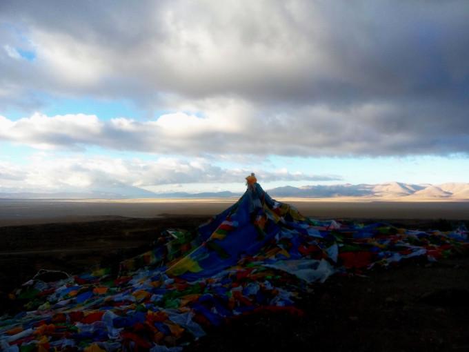
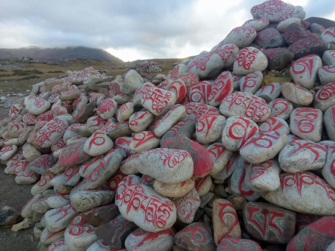
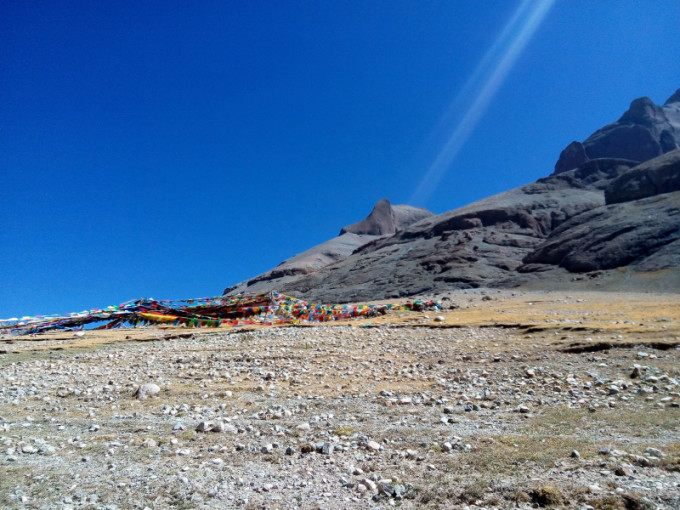
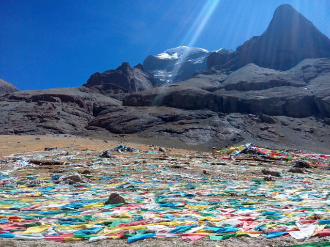
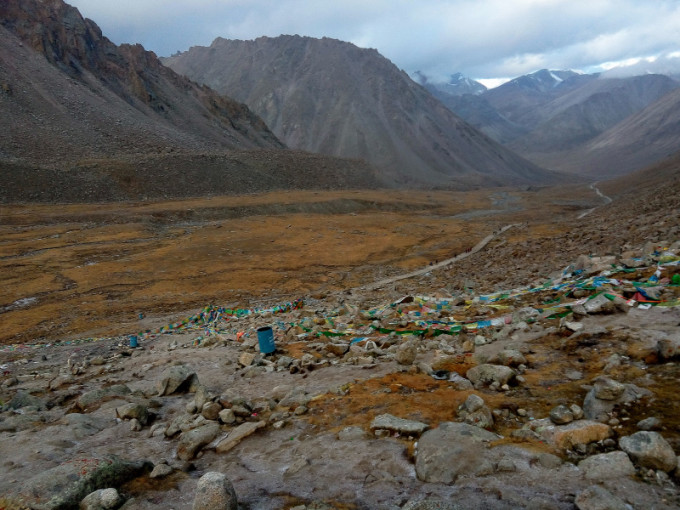
The first scene was the Worship Platform, which was decorated with a lot of Marnyi Stone and prayer flags, including a large number of colored Marnyi stones. We were eager to hurry and pass by. Nearby the Worship Platform, we saw a spectacular valley. There were some buildings in the distance, it was the gateway to Walking-around the mountain. There many tourists were waiting to start their walking-around, we were told that they arrived by car. We walked there from Darchen, taking a hour and half, and the mileage was close to 6.5 kilometers.
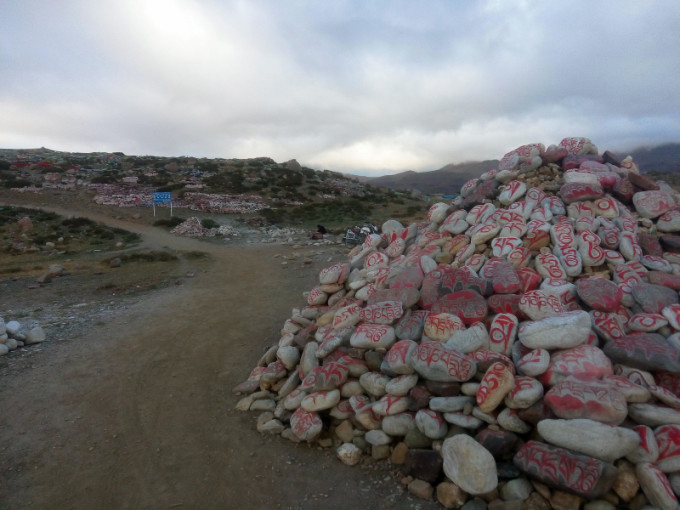
Marnyi Stones
Prayer Flags and Marnyi Stones
Road to the Valley
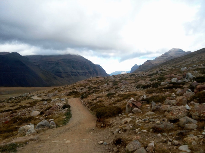
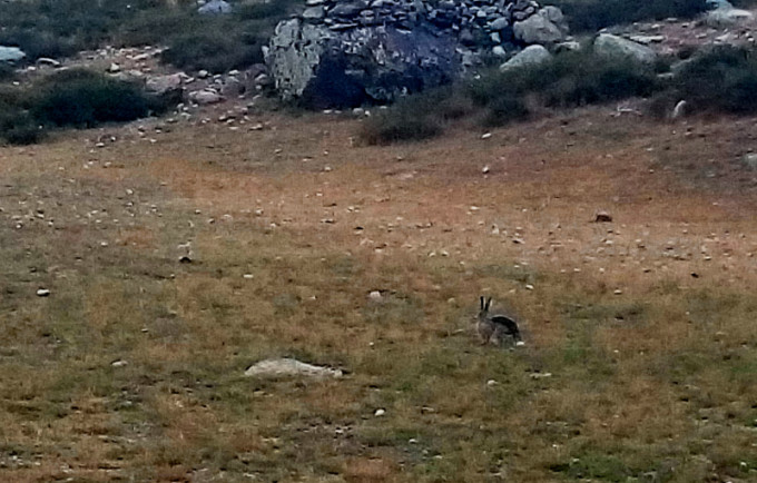
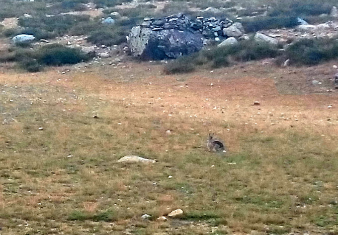
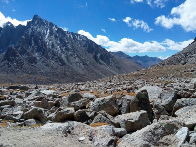
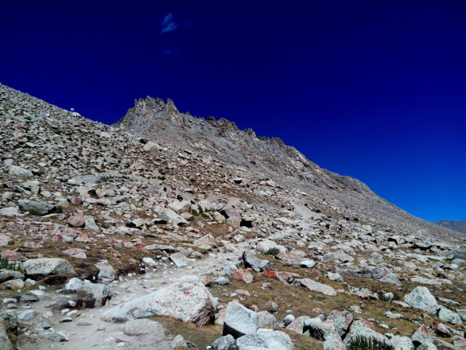
There were a lot of wild dogs in front of the gate, barking and fighting, and I had to slip away carefully. Wild rabbits can be seen on the nearby mounds, lovely and cute. It takes 2.78 kilometers to go to the Worship Platform and 2.65 kilometers to the Darbocheflagpole (经幡柱). From the right side, we saw the southwest side of the Kailash Mountain. I took pictures all the way, but it was strange that I didn’t see anyone. When we arrived at Chuku Monastery (曲谷寺) at around 10:30, it is 4,860 meters above sea level. I saw some foreign tourists and lamented that although they were older, about fifty, but both men and women seem to have rich mountaineering experience.
Valley
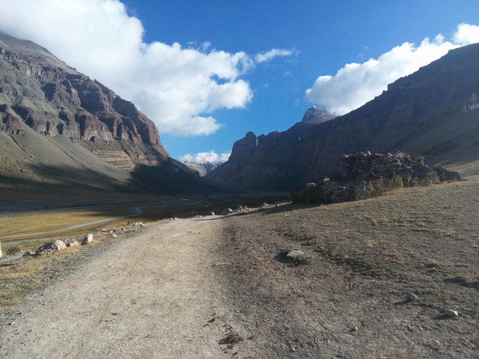
Valley
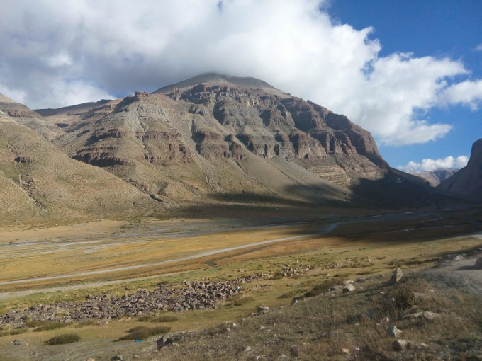
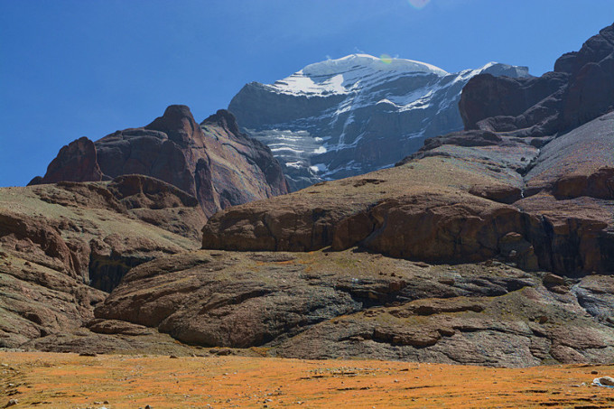
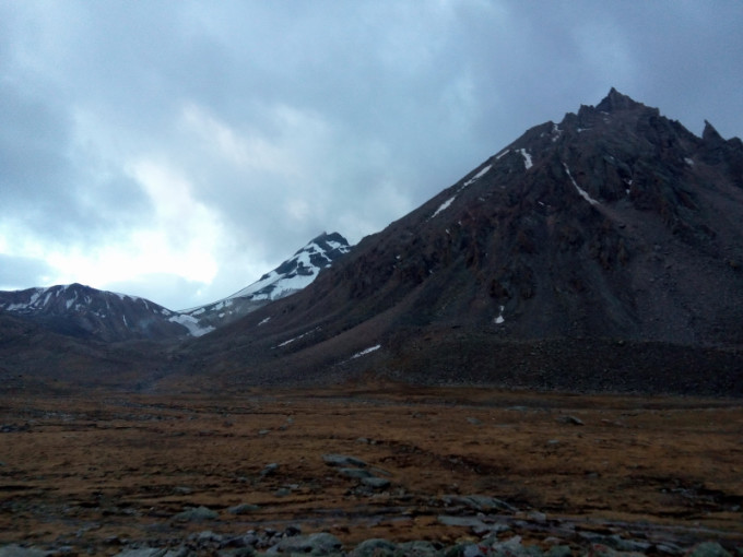
Magnificent Mountain View
Kailash – Overlook of the Southwest Side
Kailash – Southwest Side
Chuku Monastery was the first place where you can rest and replenish your energy. Spending 30 yuan in the tent teahouse and drink 3 liters of sweet tea. You feel more comfortable, and the price was quite reasonable. The attitude of Tibetan lady was very friendly.
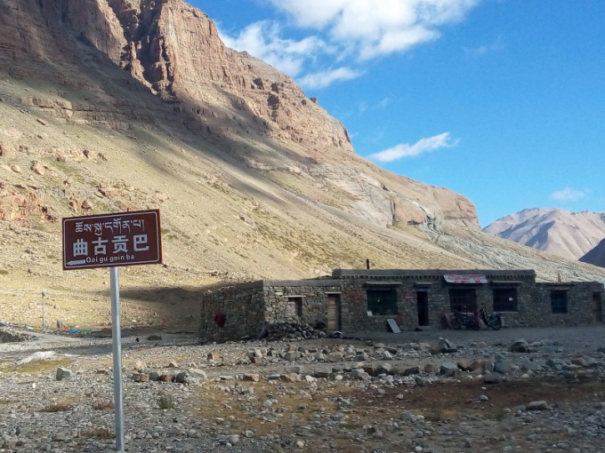 Chuku Monastery 曲谷寺
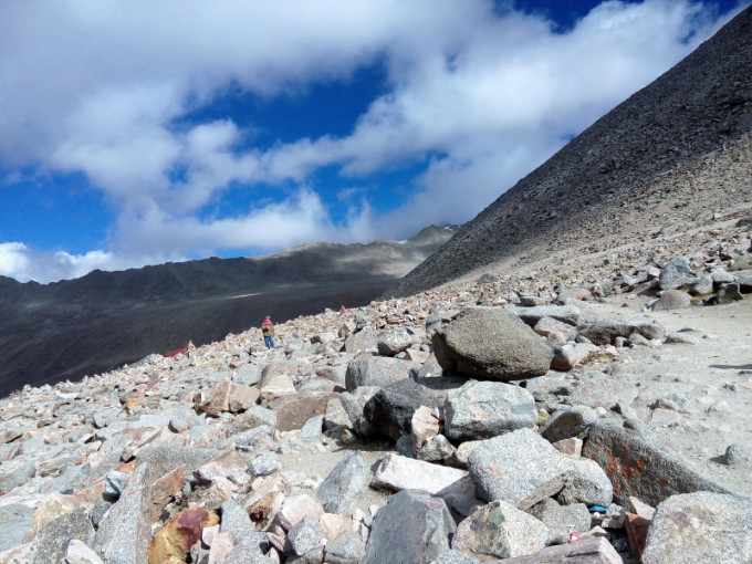
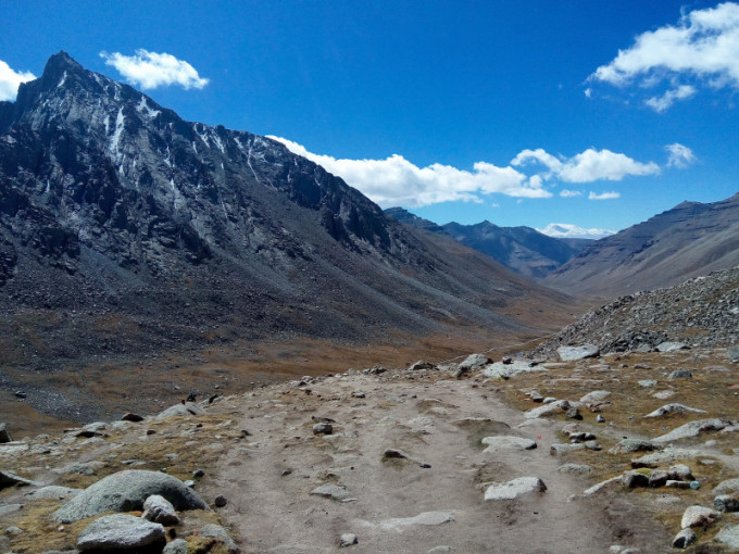
 Rest for half an hour, we continued walking to the Drirapuk Monastery about 12 kilometers away.The terrain began to rise gradually, and it was difficult to walk, especially when going uphill. I could only walk for a while, walked for an hour, finally I saw a group of Tibetans who were having kowtow, there were other people who caught up with us. Finally, the west side of Kailash had been completely presented to us. Looking up at the past, it was extremely solemn and spectacular! This road, wherever the main peak can be seen, had a large number of prayer flags and Marnyi Stones. According to the previous map, there should be a tent camp on the way to the Drirapuk Monastery for rest. Obviously this year the camp had been cancelled due to the small number of people.
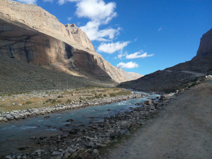
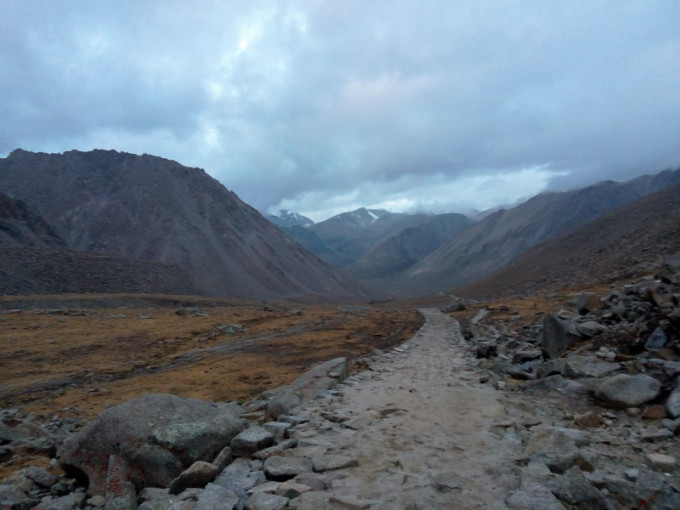
Dusty road with rubbles
For former part, you can also choose to walk in the river valley
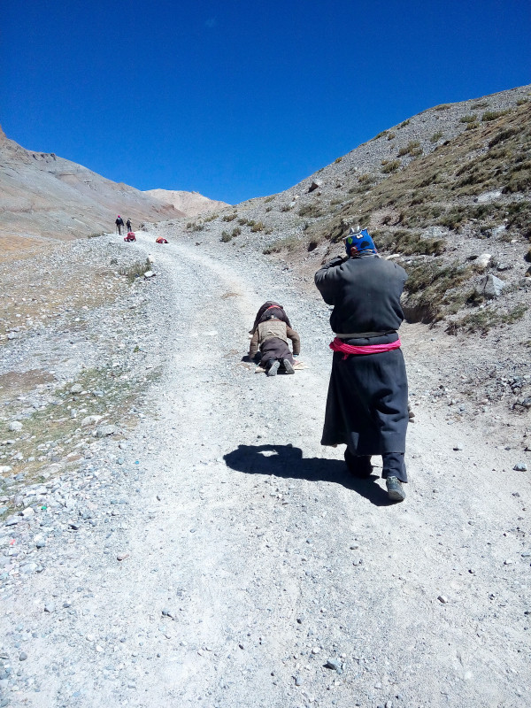
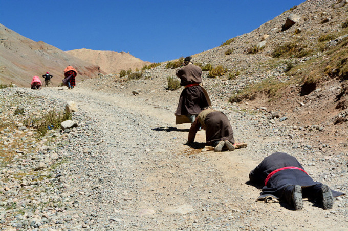
Obviously it was a family, keeping kowtow all the way up, it takes 2-3 weeks.
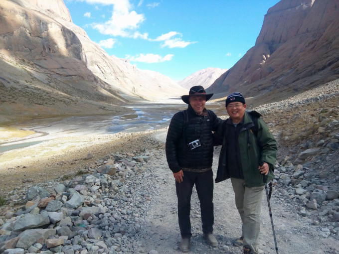
Encounter Mr. Johansson from Canada
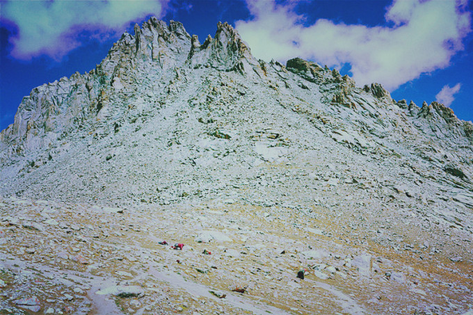
Drirapuk Monastery 止热寺
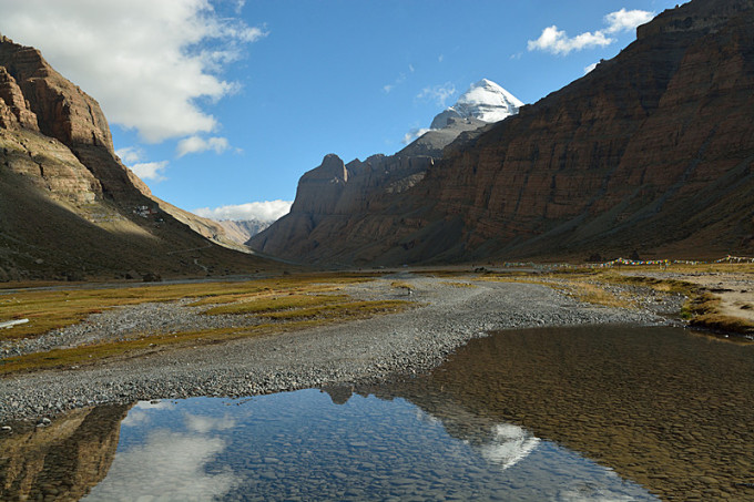
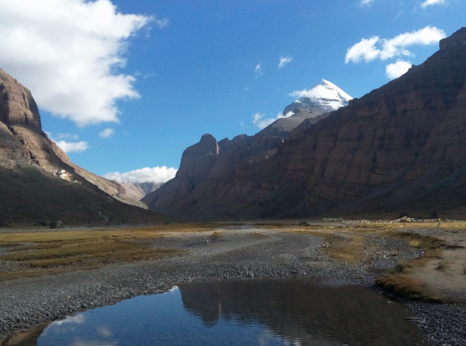
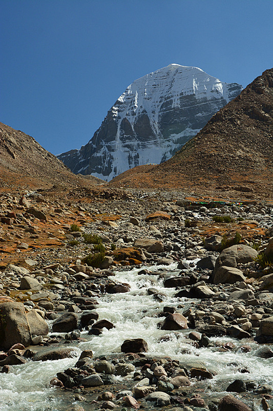
You can see the Kailash Mountain where you see the prayer flags.
West facade of Mount Kailash

Just pray in front of the Mount Kailash
Drirapuk Monastery 止热寺
Drirapuk Monastery 止热寺
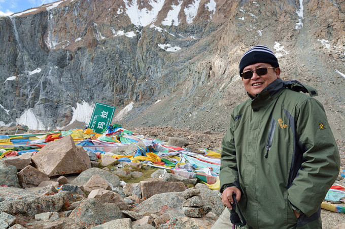
At three o’clock in the afternoon, I finally saw the temple in the distance. It should be the Drirapuk Monastery. Just came over an old Tibetan man. walking very fast, saying that it was the Drirapuk Temple. Then he said with a kind and proud smile: “You were young, although I am in my 60s, my body is still good,even better than you!” we really admire him!
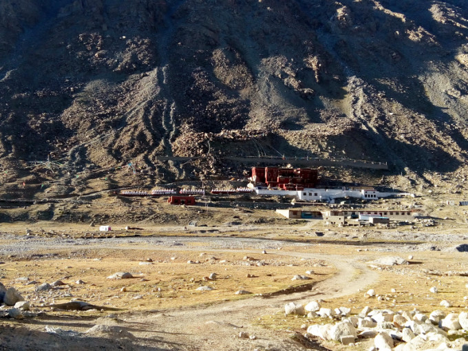
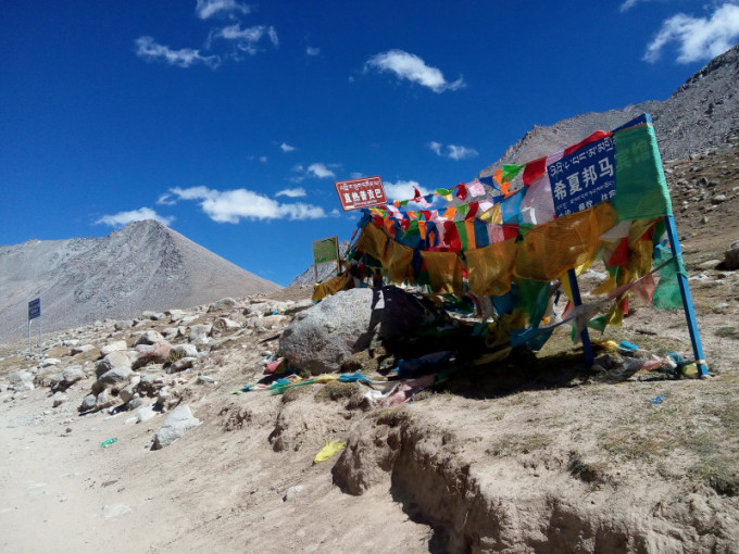
Photo with the guideboard
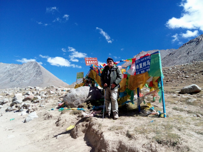 Xixia Bangma Hotel 希夏邦马宾馆
Far away to see the temple, we were faced with the choices, there was a bridge in front, the signs show that if we want to go to Drirapuk ,we must cross the bridge to the other side of the river, but if not, it should go to Xixia bangma Hotel. I checked the Raiders and said that the Xixia Bangma Hotel was in good condition. We were already very tired and there’s no more than 30km. So I decided to stay in the Xixia Bangma Hotel.
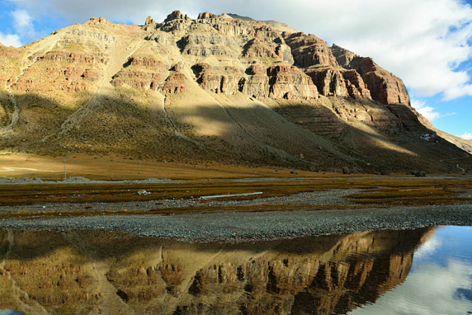
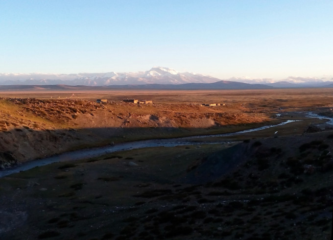
 View from the Xixia Bangma Hotel – North facade of the Kailash
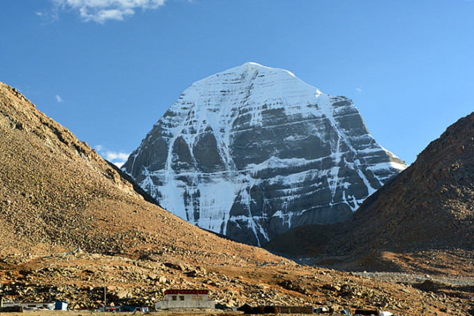 Xixia Bangma Hotel 希夏邦马宾馆
At the bridgehead, I had seen the white house of the Xixia bangma Hotel. It was about 300 meters. I didn’t expect that we were deceived by the visual illusion of the plateau. This altitude of 5,100 meters, under the clear blue sky, seems very near, the actual distance was very far ! with physical exhaustion and altitude sickness, it took us an hour to get there.
Xixia bangma Hotel was a courtyard consisting of two-storey simple rooms. There was nothing but two beds, quilt blankets and a bedside table. A bottle of boiling water was provided, and Power supply was only from 7:00 to 11:00 pm. But it still costs 300 yuan a room, so leave it, we need to had a good rest for the hard journey of the next day, then we oerdered a room for each.
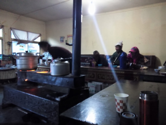 Xixia Bangma Hotel 希夏邦马宾馆
Fortunately, the hotel had a Tibetan-style reception room with a stove for heating, drinking tea, instant noodles and so on. Our jackets were soaked, and the fire was on the fireside. The sky will be dark. There were people who come in, to sit down and drink tea. A lady from Yunnan, it was her second time coming to the mountain. She took a small instrument and let everyone put her fingers on it. The heart rate and blood oxygen content were measured. The test results were very interesting. The Tibetans generally had a low heart rate of around 70. We mainlanders came up with 100 or so. The amount varies from person to person, and several Tibetans had reached the maximum of 99. (She met the old Tibetan who went toDrirapuk, and he was also 99), I am 83, not bad! Xiaoliu 70, lower! There were several Tibetan women around 80. It shows that the Tibetan compatriots had fully adapted to the high altitude environment.
 Xixia Bangma Hotel 希夏邦马宾馆
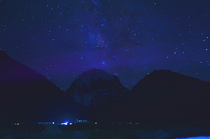
At night, it was not cold. At 23 o’clock in the evening, I tried to shoot the north facade of Kailash under the stars. Without a tripod, I could only take the camera with my clothes and put it on the stone. I only took a few shots.
Day 2 (1) – Six hours for 5000 meters altitude
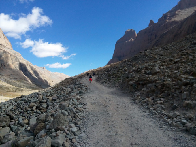
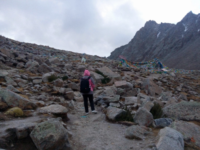
At six o’clock in the morning, it was still dark, so we got up and started off with a flashlight. There were still a lot of people who got up early and started walking around. There was only one road. There were flashlights flashing around. The road up the hill ahead had a relatively large gradient. When we reached the first platform, the Celestial Burial Platform (天葬台), it was about 3 kilometers, about an hour and a half. The energy accumulated overnight will soon wear off. The sky turned bright, but the clouds were still thick, and little snow grains fell. I’m very worried that it will turn into heavy snow. That’s terrible!
 Dolmala Pass 卓玛拉山口
In the morning, the clouds were thick and the snow falls.
 Dolmala Pass 卓玛拉山口
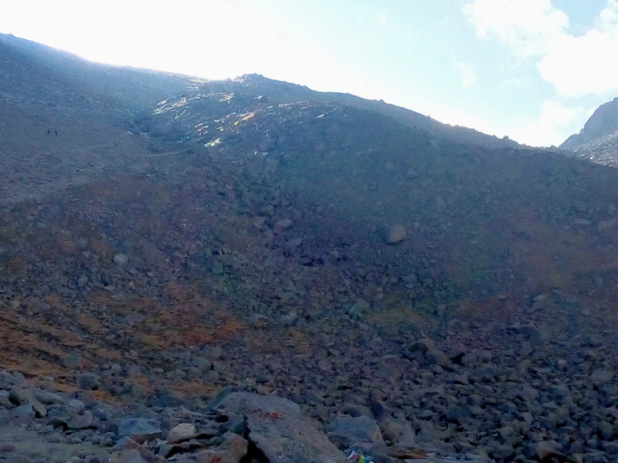
Rest for a while, going on, in front of a sloping stone slope, began to think that this was the Dolmala Pass, we tried for a long time to go up and see,but it was not the Dolmala Pass. the altitude was already 5400 meters,it will spend more physical energy. Worrying about altitude sickness, we decided to take a stop-and-go method, so that it was very slow, seeing Tibetan compatriots surpassing us one by one… Fortunately, the weather began to turn better, the temperature began to rise, and the most worrying things would not appear. The Dolmala Pass in the distance was already in sight, and I feel like we saw the hope! We were exhausted on foot, but we were shocked to see that several young men and women were riding on horses. The horses were led by Tibetans and soon overtook us. They greeted them and thought it was called a walking-around! This actually lost the meaning of walking-around.
 Dolmala Pass 卓玛拉山口
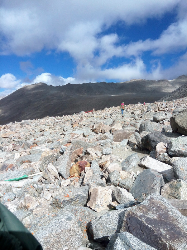
Dolmala Pass , Looking back at the gravel slope.
Dolmala Pass 卓玛拉山口
Part of our willpower was inspired by two middle-aged women, who were also suffering from high altitudes, but they were still moving forward, they can all go, we had no reason to fall behind! There was another more important truth, that was, we had no way to go but move forward! Keep moving – that was the only choice!
Dolmala Pass卓玛拉山口
Looking back at the road at an altitude of more than 5,200 meters
Dolmala Pass 卓玛拉山口
We still had no any news about the buddy, Xuri, who started first, maybe the phone had no signal. The mountain road to the Dolmala Pass was dangerous. Climbing up along the the stone slope, we had to take some glucose. Xiaoliu felt the extramity of physical strength at the height of 5,500 meters to 5,600 meters. Her face was white and the lips truned purple. But the little girl was still very tenacious. She insisted, a good-natured Tibetan friend looked at her and asked if we need help. We were afraid of delaying, so we smiled and refused. The road of Dolmala Pass was not only a test to physical strength, but also to the patience of people! I always feel that I was almost at the top, but I go up a slope and there was another slope in front. It really makes people feel desperate! I hadn’t made a count, but it was estimated that it woud be another five or more slopes that make you hope and despair, that was torturing!
卓玛拉山口 Dolmala Pass ,endless gravel slopes.
卓玛拉山口 Dolmala Pass, torturing mountain road
Dolmala Pass 卓玛拉山口
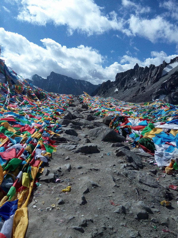
At 3,560 meters above sea level, we were close to the Dolmala Pass at 12:00 noon. Starting from the morning, the height of more than 500 meters, 6.5 kilometers of mountain road, we spent 6 hours!
The iron sign marked with Dolma was inserted in the stones. If you did not pay attention, you would miss it.
Dolmala Pass 卓玛拉山口
Above the mountain pass was a 200-meter-long, gentle platform, with a large warps above, followed by a very narrow and steep downhill path. We hoped could have a rest in a tent on the top, but there was none, so we went down.
Dolmala Pass 卓玛拉山口
Day 2 (2) – Unexpected Slope
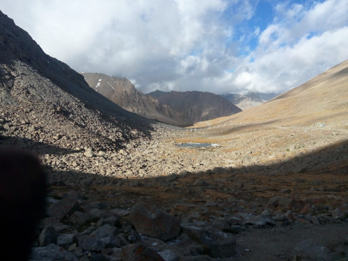
From the downhill of the Dolmala Pass to the tented camp at the foot of the mountain, the total length of the route was 2.72 kilometers. Xiaoliu had no mountaineering experience. I am very scared to see the steep downhill road. I can only walk with her step by step. On the right side of the road was a cliff, the lower part of the valley was the Mercy Lake (慈悲湖), the gray-green water surface, like a mirror, very beautiful! The main peak of Kailash could not been seen, and the opposite was the snow-capped peaks. The shape was strange, seemed like a team of samurai, or the guardian.
Dolmala Pass 卓玛拉山口
Dolmala ,Start going Down the mountain

Dolmala Pass 卓玛拉山口
Dolmala Pass, Emerald Mercy Lake
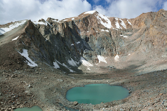 Dolmala Pass 卓玛拉山口
Dolmala Pass, Start going Down the mountain.
 Dolmala Pass 卓玛拉山口
Having passed the first dangerous slope smoothly. I thought that there was nothing behind it. My mind began to relax and the pace was much lighter. Going to the last downhill, I had already seen the tent at the foot of the mountain, thinking about the deliciousness of sweet tea, we were in a good mood! Unexpectedly, the last slope was the real danger! The slope of the rock slope was estimated to reach 50 degrees, and there were more loose stones. Without a ready-made road, you can only move the stone step by step. I had no problem, Xiaoliu could be in trouble! Still, there was no way out! Consolation and encouragement, I explored the road ahead, Xiaoliu was behind, little by little, thrilling and it took a long time to pass. I am nervous and sweaty in this section of the road. If it fails, it was the cost of life.
Not far away, there were several Tibetan women who were kowtowing and they were detoured step by step. It can be seen that although they were very tired and covered with dust, their hearts were happy and satisfying!
 Dolmala Pass 卓玛拉山口
Looking back down from the steep slope, it was conceivable that it would be very dangerous if covered by snow!
 Dolmala Pass 卓玛拉山口
Day2 (3) – No time to relax, we must go out before dark.
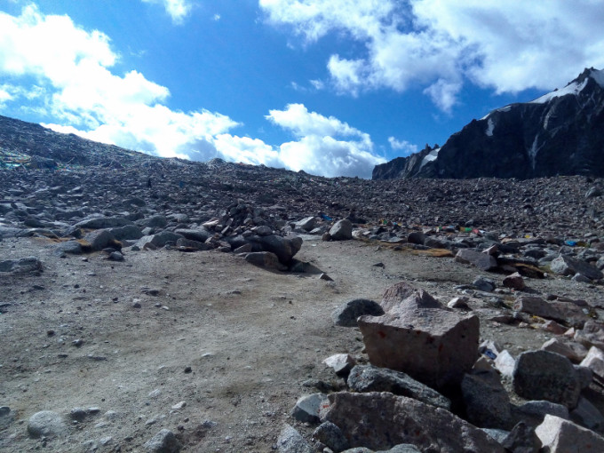
At two o’clock in the afternoon, I finally reached the tent camp at the foot of the mountain. We had no rest for eight hours. We planned to rest for an hour and then go outside. Just drinking sweet tea, the phone rang, it was the message from Xuri, saying that he came out at 12 o’clock last night, just woke up and asked where we were, I said that I was resting in the tent, he immediately replied, told me not to delay , because the back of the 20 km return mountain road was not in good codnition, after 7:30 in the afternoon the sun will be blocked by the mountain, the temperature will be very low, the last paragraph was the outward slope of the cliff road, we must go out the mountain before dark, otherwise we will be in danger!
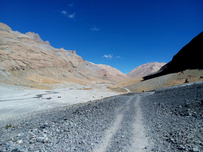
Departing at 14:30 in the afternoon, we must walk 12 kilometers to reach the Zunzhu Temple (尊珠寺) at an altitude of 4810 meters. The road was relatively flat and we turn around another mountain. We basically maintain a speed of about 4 km / h. On the mountain, that was already a very fast speed. Three hours later, we went to the Zunzhu Temple. The foreigners lived here on the same day. They took a three days itinerary. After a short rest, we continued to walk forward for more than a kilometer. I suddenly found that there was a road on the edge of the 200-meter cliff in front. The top slope was full of loose gravel, and some of them protruded. It seemed that a strong wind could blow them down. Under the slope, there was no place to escape in case the gravel rolls down. So I rushed to Xiaoliu, and ran through that dangerous road.
8 kilometers behind the Zunzhu Temple, although the first 6 kilometers were undulating, the overall was relatively flat, but the pain was to face the sun, while at the same time with strong wind and dust, wearing a mask made us difficult to breathe, with strong ultraviolet rays, I still choose to take off the mask, take photos! The sunset looks beautiful. When it was more than 7 o’clock, part of the sun was covered by the mountain. We finally walked 1.6 km from the mountain pass.
 Zongdui Mountain Pass 宗堆山口
With the physical strength approaching the limit, it was bad to see that the last section of the road was actually uphill. Fortunately, on the height of 100 meters, after going up to the slope, the front was the cliff road that was sloping outwards as mentioned by the rising sun. The road was narrow and slippery. If it falls, there is no way for servival. We will rest for a while and accumulate physical strength. After that, all the way forward, then the role of trekking poles was very vital, but we thought it was a few hundred meters, I did not expect the 1.6 km was such a dangerous road! I really didn’t know how the Xuri passed the last part in the middle of the night!
Finally, at 20:30 in the afternoon, we finally walked out of the Zongdui Pass and completed the walking-around of the Mount Kailash, and successfully challenged ourselves!
The white house with the car parked was the checkpoint.
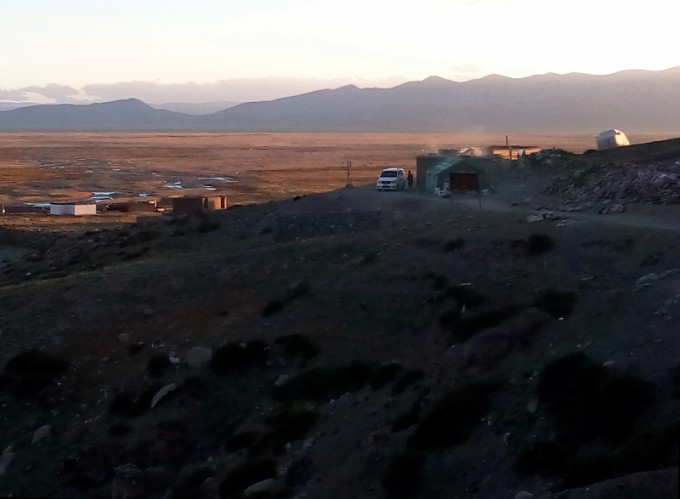 Zongdui Mountain Pass 宗堆山口
Complete the Mountain Pilgrimage and celebrate with peers!
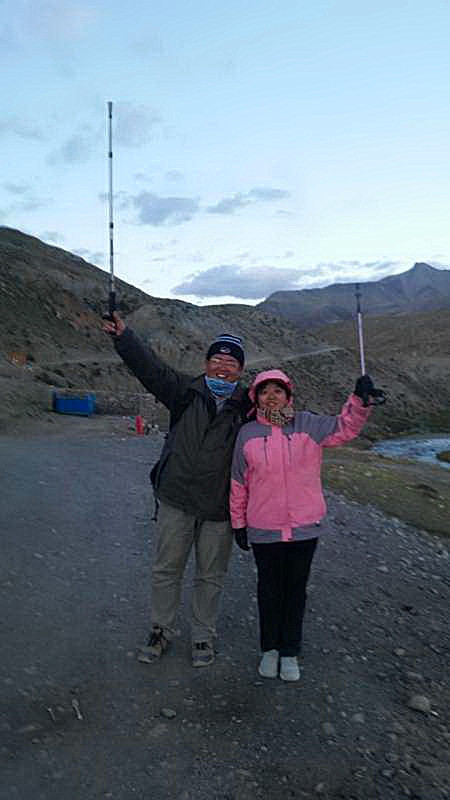 Zongdui Mountain Pass 宗堆山口
Postscript
In fact, after returning from the mountain, I found that my physical strength was still ok. Given me a second chance to get up early, follow my own pace, and the time of one day should be Ok, but the two-day trip was more reasonable. Because the last part of the road was too dangerous to go at night, it was not clear, and it was very cold! Xuri save a girl who was left behind. She was afraid to go in the middle of the road, crying there, but fortunately Xuri passed by!
All three of us had sunburns to varying degrees, and they were all purple on face. I was more serious. After three days, all the skins were peeling off. It got better a week later. Not to mention the dust covered with face.
Walking around Mount Kailash is definitely an extreme challenge. The altitude is basically about 5 kilometers. It was difficult to walk down without physical strength and willpower. The scenery of the front 20 kilometers was spectacular and beautiful. More than 30 kilometers behind it had been inadvertently appreciated. I just hope to get out of the mountain pass soon.
There are several very dangerous sections down the mountain, you need to had some climbing experience, and you were bold and careful.
Gaoyuan’an oral liquid (高原安口服液) and glucose oral liquid were very necessary, the fastest way to replenish physical strength and anti-altitude.
I brought a Nikon D7100, plus a F2.8, 17-55mm Nikkor lens, a heavy telephoto and a tripod left in the inn. Some pictures with significantly poor pixels were taken with Huawei mobile phones.
Remind that when the victory arrives at the Zongdui Mountain Pass, didn’t forget to ask for a certificate of certifying that you have finished the mountain pilgrimage. I only heard that there was still such a step when I left Lhasa.
Chinese Version: http://www.mafengwo.cn/i/5332546.html


