


Rutog County
Rutog County Overview
Chinese Name: 日土县 English IPA: Rì Tǔ Xiàn Location: A large western county of the Tibet Autonomous Region Population (city): 6,300(2003) Language: Tibetan language and mandarin Chinese Zip code: Tel code: Time zone:
Rutog County is a large western county of the Tibet Autonomous Region of the People’s Republic of China. Its capital, Rutog is located some 1,140 km (710 mi) or 700 miles west- northwest of the Tibetan capital, Lhasa.
The county has a rich history of folk tales, myths, legends, proverbs and folk songs and has a large number of caves, rock paintings and other relics. The Xinjiang-Tibet Highway runs through the Rutog County for 340 km (210 mi). The county, established in March 1961 covers 74,500 km2 (28,800 sq mi) but has a very low population density with a population of 6300 (2003).
Highlights of Rutog County
Rutog Rock Paintings: In 1985, rock paintings were found at several sites in Rutog County. This was the first time such finds had been made in Tibet. The rock paintings at a dozen places within Rutog, including Risum Rimodong and Lorinaka, are not only large in size and great in number, but are also of high artistic value.
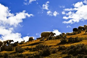
Qiangtang Nature Reserve: Qiangtang nature reserve as the biggest nature reserve was founded in 2000, which located in northern of Tibet, southern of Mt.Kunlun and Hoh Xil, northern of Mt.Gangdisi and Mt.Nien ching tanggula. It total area is about 29.8 million hectares, its area just secondly to Greenland National Park in the world. At the same time it is the highest latitude nature reserve.
The Karakoram Mountains: The Karakoram, or Karakorum is a large mountain range spanning the borders of Pakistan, India, and China, with the northwest extremity of the range extending to Afghanistan and Tajikistan.
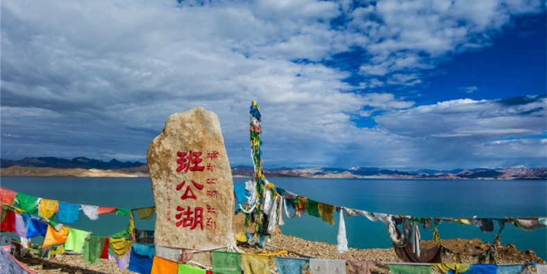
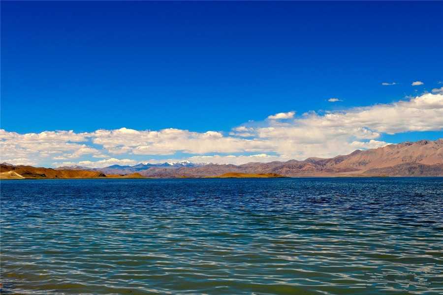
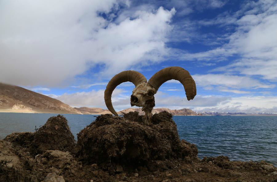
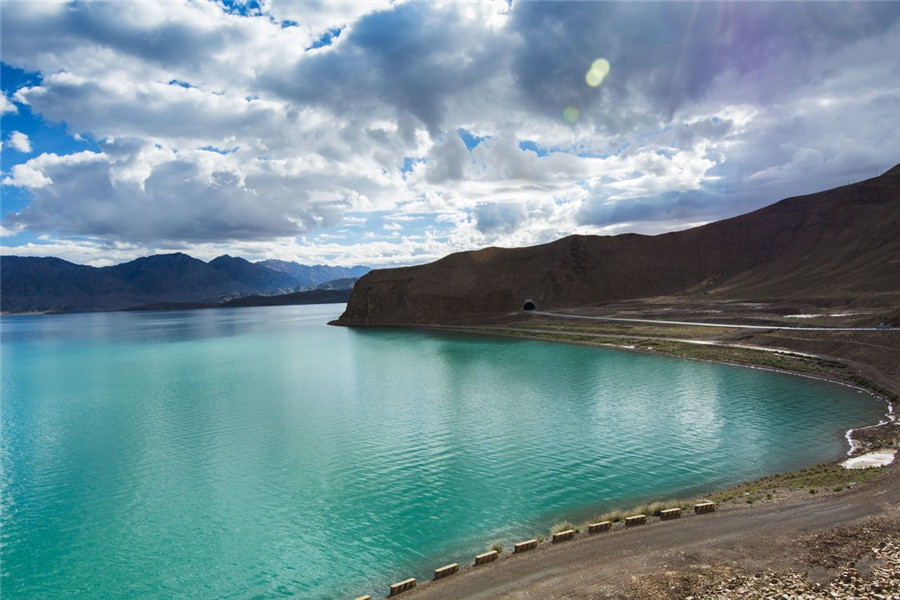
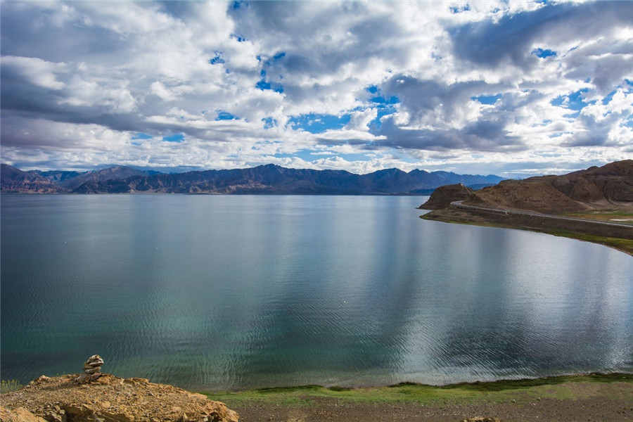
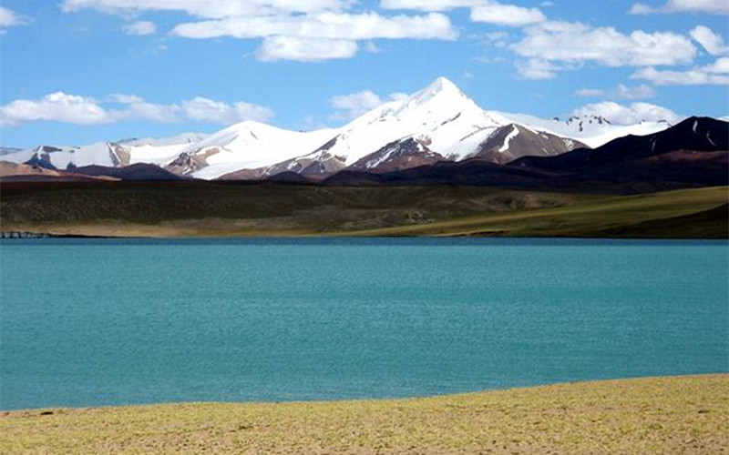
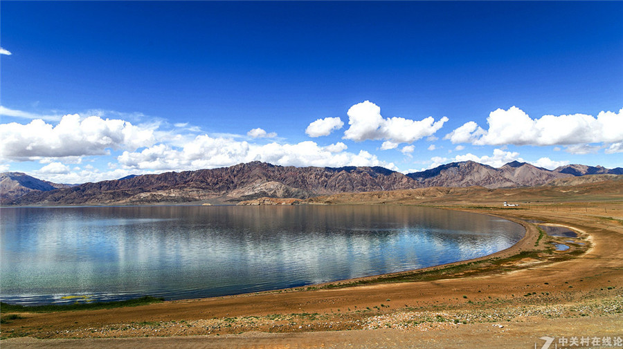
Bangda Lake: Bangda Lake also Bangdag or Bangdacuo, is a glacial lake in Ngari Prefecture in the northwest of the Tibet Autonomous Region of China. It lies in the western Kunlun Mountains, to the southeast of Guozha Lake. Located at an altitude of 4902 metres, it covers an area of 106 square kilometres with a maximum depth of 21.6 metres and contains 90 glaciers.
Guozha Lake: Guozha Lake, also Gozha Co, Gozha Tso or Guozhacuo, also known as Lake Lighten, is a glacial lake in Rutog County in the Ngari Prefecture in the northwest of the Tibet Autonomous Region of China. It lies in the western Kunlun Mountains to the northwest of Bangda Lake, not far from the regional border with Xinjiang. Located at an altitude of 5080 metres, it covers an area of 244 square kilometres with a maximum depth of 81.9 metres and contains 62 glaciers.
Longmu Lake: Longmu also Longmu Co or Longmucuo, is a glacial lake in Rutog County in the Ngari Prefecture in the northwest of the Tibet Autonomous Region of China. It was investigated in 1989 in a Sino-French expedition to western Tibet.
Lumajangdong Co: Lumajangdong Co or Lumajiang Dongcuo is a lake in the Ngari Prefecture, Tibet, China with an area of 250 km². It is located at 34° 2′ 0″ and 81° 40′ 0″. Gormain lies a few miles (5–7 km) to the northwest.
Wo Erba Lake: Orba Co, also Wo Erba or Wo Erbacuo, is a lake in Rutog County in the Ngari Prefecture in the northwest of the Tibet Autonomous Region of China. It lies at an elevation of 5,209 metres (17,090 ft), to the southeast of Longmu Lake. The lake has four major islands which are the islands with the highest altitude on earth.
Other Destinations in Rutog County
Rutog County Attractions
Attractions of Rutog County About Rutog Rock Paintings Rock painting is a kind of stone carving culture. During the early development of human society, people described and recorded their way of production and life through a simple and natural form- stone inscription. This phenomenon became a precious cultural heritage left by ancestral people. In 1985, rock paintings were found at several sites in Rutog County. This was the first time such finds had been made in Tibet. The rock paintings at a dozen [...]
More Rutog County Attractions >>
Rutog County Tours
As the Top Tibet tour operator, MysteriousTibet promises to present the ultimate travel experience to world-wide tourists via a galaxy of carefully-engineered tour products. Our quality service begins as our thoughtful travel consultants handle your emails to inquire a customized Tibet tour. And throughout the tour, they will together with our client service manager in Ngari Rutog County provide back-up service for you. All our seasoned Tibetan guides are well-trained and hospitable. They are ready to help you out whenever you [...]
Climate & When to Go
Geography and Climate Although when the county was established in 1961 it was part of the Xinjiang Uygur Autonomous Region, in 1978 it became a part of the Tibet Autonomous Region, under the jurisdiction of the Ngari Prefecture. Rutog County is located in northwestern Tibet, Ngari northwest with a number of territorial borders. It is divided into 12 townships and 30 village committees. The Karakoram Mountains go through the county. The average altitude of 4,500 m (14,800 ft) with a maximum [...]
More Rutog County Climate & When to Go >>
Transportation
The China National Highway 219 passes through Rutog County. Recommended Routes and Transportation 1. At Lhasa you can take a long-distance bus to Shiquanhe, costing CNY600-700. Upon arrival at Shiquanhe, you can take a direct bus to Rutog County, which is only around 12 kilometers (7.4 miles) from the destination. There you can rent a car for the rest of the journey. Or you can rent a car at Shiquanhe to reach the attraction directly. 2. Fly from Lhasa to Ngari, [...]
More Rutog County Transportation >>
Festivals and Activities
Ngari Festivals Except for Tibetan traditional festival, such as Tibetan New Year Festival, Tibetan Bathing Festival, Tibetan Shoton Festival, Tibetan Horse Racing Festival and Buddha Exhibition Festival, there are three special festivals in Ngari Prefecture. Ngari Festivals – Tarchen Buddhist Activity The Tarchen Buddhist Activity is held in the Darchen Village, at the mountain foot of Mt. Kailash. On April 15th in Tibetan Calendar in every year, the Tarchen Buddhist Activity starts. At the same time, the activities of worshipping holy mountain [...]
More Rutog County Festivals and Activities >>
Travel Tips
Tips: 1. As well as the Tibet Entry Permit, you also need to apply for Border Permit for traveling as this destination lies near the Chinese territory boundary. 2. Owing to the long distance and circuitous route, it is better to head for the attraction in the early morning. 3.There are inns and restaurant, where you can have a rest and a bite to eat. you can also take a picnic if you like. 4. May and September is the [...]
More Rutog County Travel Tips >>
Useful Maps
These maps are about Ngari Rutog County, including location maps, region maps, tourist maps, attractions maps, and transportation maps. [...]
More Rutog County Useful Maps >>
Rutog County Accommodation
In each destination, you’ll enjoy a comfortable stay in a great location! The hotels we choose are based on star rating, great locations, well-equipped facilities, cozy bed, high quality service and guests’ feedbacks. Choices are a lot ranging from luxury 5 star, comfortable 4 star to budget 3 star. You could decide where to stay to best suit for your budget and likes. Generally, the hotels have both Western and Chinese breakfast with a wide choices. If you have already [...]
More Rutog County Accommodation >>


